ABC News
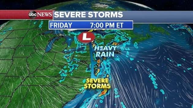
 ABC News(NEW YORK) — The same storm system that brought 11 confirmed tornadoes to the South will move east Friday and bring severe thunderstorms from the Carolinas to the Mid-Atlantic while heavy rain arrives in New England.
There were seven tornadoes in Louisiana from Wednesday into Thursday, including the strongest, an EF3 tornado in Ruston that killed two people.
As the storm reaches the East Coast, the greatest threat for severe weather and the heaviest rain will be Friday afternoon and into the evening hours.
The most severe storms will cover an area extending north from Wilmington, North Carolina, through Raleigh, North Carolina; Richmond, Virginia; Washington, D.C.; and into Philadelphia.
The biggest threat with these storms will be damaging winds over 60 mph, and possibly a few tornadoes and flash flooding.
Spring snowstorm
A storm system will move out of the Rockies late Friday into Saturday morning and spread rain and snow into the Dakotas for Saturday morning.
The storm system will move into the Midwest on Saturday afternoon, spreading a swath of snow from southern Minnesota into Iowa, Wisconsin, Illinois, Michigan and Indiana.
The heaviest snow will fall in southern Minnesota, northern Iowa, southern Wisconsin and northern Illinois, where some areas could see close to a half a foot of snow.
At this time, it looks like the heaviest snow will stay south of the Twin Cities and just north of Chicago, but since Chicago is very close to the heavy snow it could be in trouble if the storm track shifts further south.
Copyright © 2019, ABC Radio. All rights reserved.