ABC News
 ABC NewsBy MAX GOLEMBO, ABC News
(NEW YORK) — A major storm system moved through the eastern half of the U.S. Thursday into Friday, bringing flooding rain and damaging winds.
In just hours Thursday, more than 3 inches of rain fell from Virginia to New York, producing flash flooding. In Wisconsin and Michigan, rainfall totals topped 5 inches.
Some of the highest wind gusts were in the Northeast, with winds up to 71 mph in Salem County, New Jersey.
At the Philadelphia International Airport, winds gusted to near 50 mph and in Chester County, Pennsylvania, wind gusts reached 63 mph.
In Miami, the same storm system brought severe thunderstorms that produced wind gusts up to 66 mph.
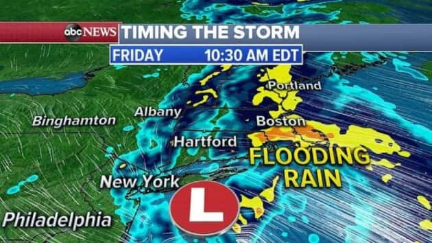
Meanwhile, flood watches continue in Pennsylvania and New York Friday, as the heaviest rain begins to move into New England.
The storm system will pass over Long Island Friday morning and afternoon, spreading very heavy rain into Boston and coastal New England, where flooding is possible.
Storms will continue to move along coastal New England throughout the day, producing heavy rain for the area.
Some thunderstorms with heavy rain could form as far south as New York City and New Jersey. If the rain is persistent enough in these storms, additional flooding is possible.
As the East Coast soaks, a record heat wave begins in Texas for this weekend.
Record highs are possible Friday in Midland, Texas, where the city could reach 100 degrees for the first time this year.
Also, a record high is expected in Amarillo, Texas, with temperatures that could reach 97 degrees.
Record heat does not stop Friday. Temperatures near 100 degrees or higher will continue into early next week for most of Texas. Even Dallas and San Antonio could reach their first 100 degrees days of the year.
Copyright © 2020, ABC Audio. All rights reserved.