ABC News
 ABC News(NEW YORK) — The same dose of tropical moisture that dumped 13 inches of rain in Boone, North Carolina, over the weekend is expected to make its way into the Northeast to start the work week.
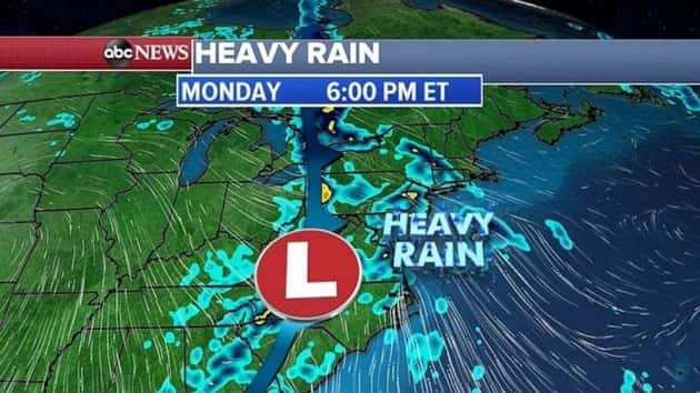
More rain is also expected for the Carolinas Monday as a combination of a cold front and a low pressure move along the East Coast.
The storm system was stretching from the Great Lakes to the Gulf Coast on Monday morning as it moved east.
Heavy rain is expected from the Carolinas to the Northeast by Monday’s evening rush.
The heaviest rain in the Northeast will fall Monday evening into the early morning hours on Tuesday, when some areas could see flash flooding.
Record heat and fire danger
Several record highs were broken or tied in the San Francisco Bay area Sunday, including 92 degrees at San Francisco International Airport — the hottest temperature in San Francisco in almost two years.
Four states are under heat watches and warnings from Arizona to Oregon.
With all the heat and dry air, wildfires have exploded in the West, around Phoenix and also from Southern to Northern California.
Triple-digit heat will continue Monday from Arizona to almost Oregon. More record highs are possible in California with 95 degrees expected in San Francisco and 103 degrees expected in Sacramento.
This heat wave will spread farther north into Oregon over the next few days, with record highs possible all the way to Portland by Wednesday.
Copyright © 2019, ABC Radio. All rights reserved.